Descripción
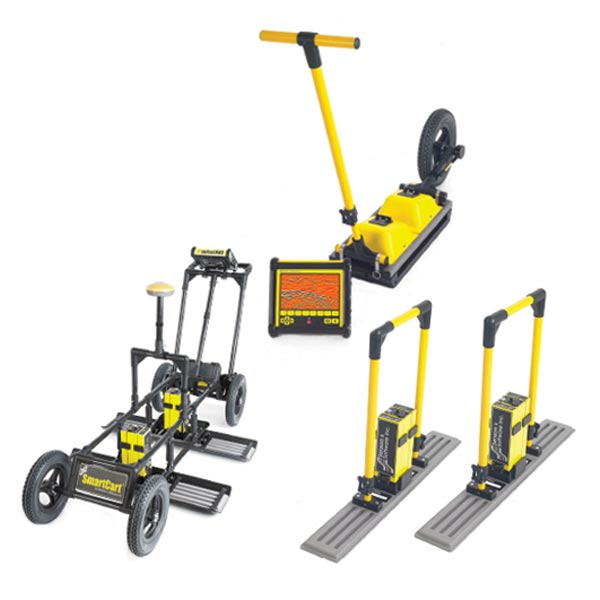
Los sistemas de georadar pulseEKKO® GPR proporcionan un rendimiento sin igual con una amplia gama de frecuencias para aplicaciones que van desde la exploración de minerales profundos y la glaciología hasta las investigaciones geotécnicas de alta resolución y las imágenes de hormigón. SYSTEM OVERVIEW pulseEKKO® is designed to meet the needs of GPR professionals, addressing many GPR applications. The operating bandwidth is selectable from 12.5 MHz to 1000 MHz to optimize the spatial resolution required by target size and exploration depth. The fully bistatic design enables variable antenna offsets and orientations for advanced survey types such as multi-offset, transillumination and multi-polarization. Low system noise paired with high-accuracy digital acquisition directly at the receiving antenna results in unprecedented depth of penetration.
Many deployment configurations are available for practical field operation. Data are acquired in Sensors & Software’s industry standard file format for analysis with a range of processing and visualization software products.
APPLICATIONS
- Geological stratigraphy: Profile subsurface stratigraphy, structure and the bedrock surface
- Mining & Quarrying: Detect changes in rock type, fractures, faults and joints for safety and resource development in underground mines
- Geotechnical & Environmental: Map depth to bedrock, detect sinkholes, locate underground storage tanks (USTs) as well as septic systems, drainage systems on golf courses and farms
- Forensics & Archaeology: Law enforcement uncover buried caches of drugs, money, weapons and clandestine graves. Archaeologists image underground artifacts, tombs and the foundations of ancient structures
- Glaciology, Ice & Snow: Measure the thicknesses and image the internal structure of glaciers and ice sheets for polar ice-cap and climate change research. Measure snow depth for water resource management and ice thickness for ice road safety.
- Structure assessment: Assess the interior of concrete and pavement for asset management and maintenance planning


